GeneralBreaking NewsBreakingLatest News
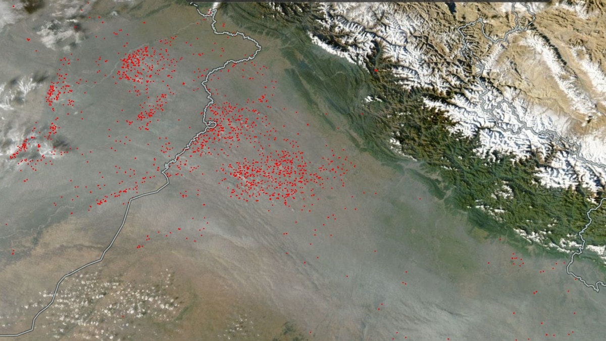
NASA Satellite Captures Thick Smog and Farm Fires Across India-Pakistan Border
Sentiment: NeutralHigh Priority
What Happened?
NASA imagery shows widespread farm fires and smoke across the India-Pakistan border, worsening air quality in Delhi-NCR due to sluggish winds. The satellite data reveals numerous hotspots in Punjab and Haryana.
Key points
- NASA's satellite imagery shows clusters of farm fires in Punjab and Haryana.
- Air quality in Delhi-NCR has deteriorated sharply, with AQI readings between 300 and 500.
- Sluggish northwesterly winds are trapping pollutants over the northern plains.
- Residents are advised to limit outdoor exposure and wear masks.
- The situation is exacerbated by smoke from agricultural fires combining with other pollution sources.
Key insights
- The accumulation of smoke may lead to increased health risks for vulnerable populations.
- Agricultural practices across borders contribute significantly to regional pollution.
- Meteorological conditions are unlikely to improve air quality in the short term.
Why it matters
The worsening air quality could affect the health of residents in Delhi-NCR.
Entities
NASA· OrganizationDelhi· CityPunjab· StateHaryana· StatePakistan· Country
Source
India Today