GeneralTop StoryTop StoryLatest News
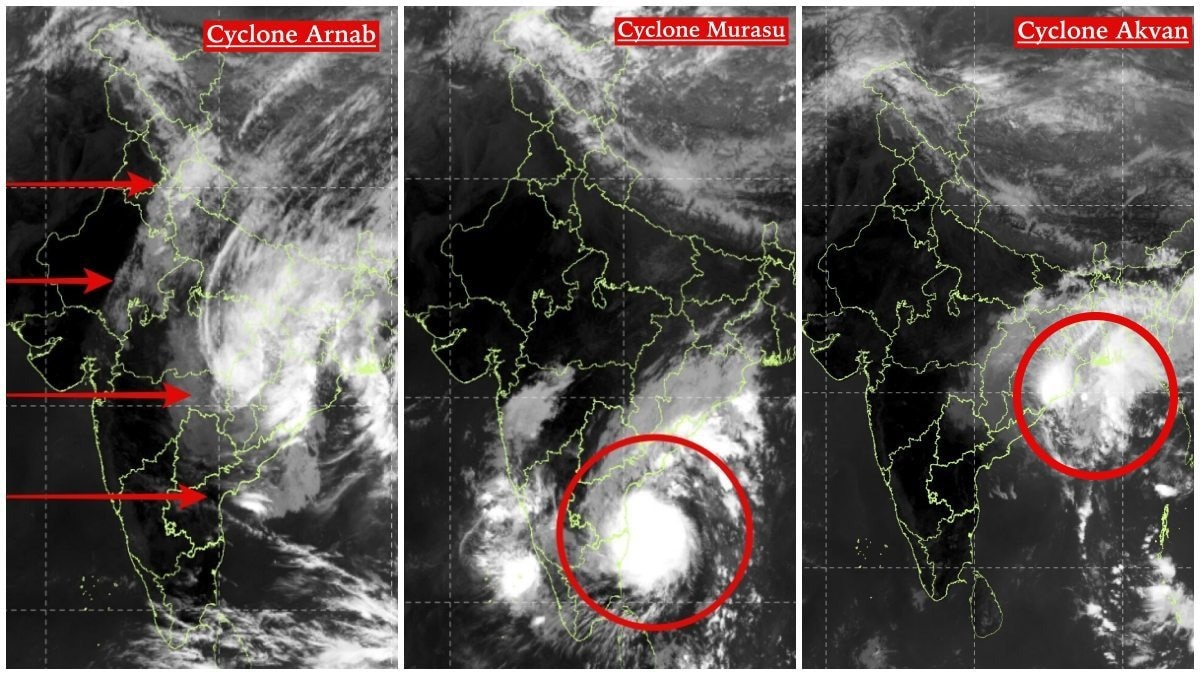
Three Cyclones in a Month: Satellite Images Show Differences in Avkan, Arnab, and Murasu
Sentiment: NeutralHigh Priority
What Happened?
India has experienced three cyclones in a month, with satellite images revealing distinct differences in their structures and impacts. Cyclones Avkan, Arnab, and Murasu exhibited varied atmospheric patterns.
Key points
- Cyclone Avkan made landfall on November 20 with winds of 70-80 kmph.
- Cyclone Arnab was the strongest, hitting the coast on October 28 with winds of 125-135 kmph.
- Cyclone Murasu crossed the coast on November 3 with winds of 100-110 kmph.
- Satellite images show Avkan's cloud structure as asymmetric and widespread.
- Arnab's cloud formations were broad, indicating a strong weather system.
- Murasu had a compact cloud structure with a concentrated convective core.
Key insights
- The distinct structures of the cyclones highlight the complexity of tropical weather systems.
- Meteorologists can use satellite imagery to better understand cyclone behavior and impacts.
- The varying intensities of the cyclones may influence regional weather patterns differently.
Why it matters
Understanding the differences in cyclone structures can help improve forecasting and preparedness for future storms.
Entities
Avkan· EventArnab· EventMurasu· EventIndia· CountryBay of Bengal· Location
Source
India Today